
.. statistical mapping & visual data analysis … Geographic Information Systems (GIS) provide flexible and powerful capabilities to combine maps/geography with statistical data. In our increasingly data rich environment, we often experience “drowning in data.” GIS tools can help harness disparate and voluminous data and assist with data linkage. We are continuing to update the Mapping Statistical Data (MSD) program, providing access to ready-to-use, “production” GIS projects and datasets that you can use. This post reviews GIS tools that help enable this .. gaining insights by mapping and geospatial analysis of statistical data. Take a look at the recent addition .. census tracts experiencing persistent poverty. Follow this blog to learn about new, additional projects added to the MSD program.
The Virtual Data Analytics (VDA) Geographic Information System (about GIS) tools/resources operate on two platforms. The VDA Desktop GIS (VDAD) operates on a Windows computer. The VDA Web GIS (VDAW) operates on most devices, including Macs and phones, and is accessed/used with a browser. VDAD and VDAW can optionally use the same GIS project. Three examples of using the Congressional Communities GIS project using different VDA GIS tools are shown below. They look almost identical (the objective). Click graphic for larger view. See more about the Congressional Communities project.
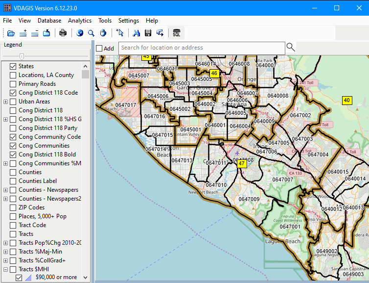
VDA Desktop GIS – Opening a Local GIS Project
In this example, all files are stored locally.
The user interface is managed by VDA Desktop GIS program on the local computer.

VDA Desktop GIS – Opening a Web GIS Project
In this example, all files are stored on a VDA GIS server.
The user interface is managed by VDA Desktop GIS program on the local computer.
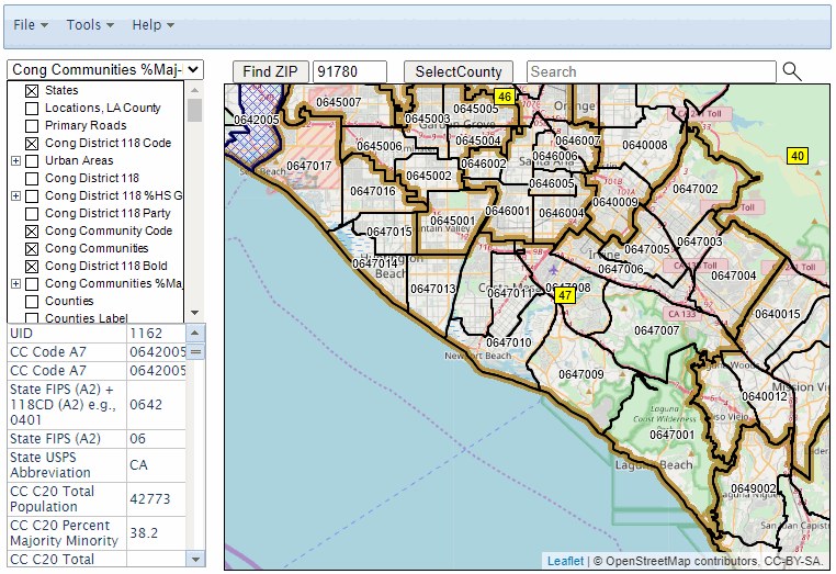
VDA Web GIS – Opening a Web GIS Project
In this example, all files are stored on a VDA GIS server.
The user interface is managed by VDA Web GIS on a VDA server.
About VDA GIS
There are two VDA GIS tools that have similar features that can be used separately or together. Each is a decision-making information resource designed to help stakeholders create and apply insight. VDA Web GIS is access/used with only a Web browser; nothing to install; GIS experience not required. VDA Desktop GIS is installed on a Windows computer and provides a broader range of capabilities compared to VDA Web GIS. VDA GIS resources have been developed and are maintained by Warren Glimpse, ProximityOne (Alexandria, VA) and Takashi Hamilton, Tsukasa Consulting (Osaka, Japan).
Data Analytics Web Sessions
Join us in the every Tuesday, Thursday Data Analytics Web Sessions. See how you can use VDA Web GIS and access different subject matter for related geography. Get your geographic, demographic, data access & use questions answered. Discuss applications with others.
About the Author
Warren Glimpse is former senior Census Bureau statistician responsible for national scope statistical programs and innovative data access and use operations. He is also the former associate director of the U.S. Office of Federal Statistical Policy and Standards for data access and use. He has more than 20 years of experience in the private sector developing data resources and tools for integration and analysis of geographic, demographic, economic and business data. Join Warren on LinkedIn.
