
.. the approximate 100,000 K-12 public schools can be examined using the Visual Data Analytics VDA Web GIS with the K-12 Schools & School Districts GIS project. This Web based resource is ready-to-use with only a Web browser, supports most devices and requires nothing to install. This section provides an introduction to this resource and how it can be used to locate schools of interest and examine them in context of other geography and subject matter — like economic prosperity.
K-12 Schools in Context of School Districts & Economic Prosperity
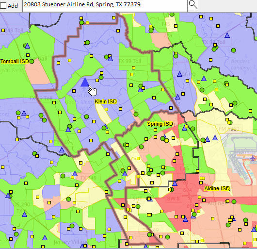
The following graphic shows the focus area for this blog. It shows K-12 public schools as markers in context of Klein ISD, TX school district (bold brown boundary) and patterns of economic prosperity by census tract. The search bar above the map contains an illustrative address to be located. The user would replace this address with their own address of interest using any address, anywhere. In this example, the location is shown by the larger blue triangle at the pointer.
Using VDA Web GIS with the K-12 Schools & School Districts Project
With any Web browser (desktop recommended, but any device), proceed as follows:
.. Click Start VDA Web GIS and sign-in
.. On the second page, optionally install VDA Desktop GIS (not necessary)
.. On the third page select the “K-12 Schools & School Districts” project
.. after the full map interface opens (5-10 seconds),
– key in the address “20803 Stuebner Airline Rd, Spring, TX 77379” (no quotes)
in search bar above map and press enter
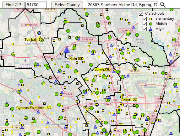
.. in legend panel at left, click on the “K12 Schools” layer checkbox
.. zoom-out (button below map) until this view appears:
View with K-12 Schools Layer
Viewing Median Household Income by Census Tract
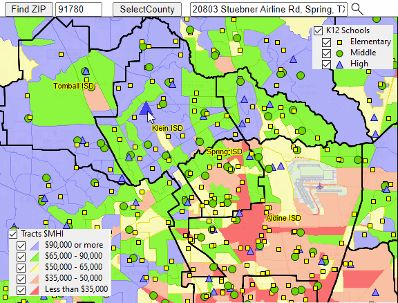
.. in legend panel at left, click on the “Tracts by $MHI” layer checkbox
Zoom-in Viewing Attributes of Selected Schools
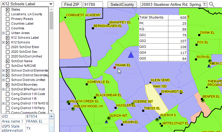
.. in upper left dropdown, select active layer as “K-12 Schools”
.. zoom-in to view shown below
.. click on Frank ES marker to show a profile
.. partial example shown graphic (enrollment by grade)
About VDA GIS
There are two VDA GIS tools that have similar features that can be used separately or together. Each is a decision-making information resource designed to help stakeholders create and apply insight. VDA Web GIS is access/used with only a Web browser; nothing to install; GIS experience not required. VDA Desktop GIS is installed on a Windows computer and provides a broader range of capabilities compared to VDA Web GIS. VDA GIS resources have been developed and are maintained by Warren Glimpse, ProximityOne (Alexandria, VA) and Takashi Hamilton, Tsukasa Consulting (Osaka, Japan).
Data Analytics Web Sessions
Join us in the every Tuesday, Thursday Data Analytics Web Sessions. See how you can use VDA Web GIS and access different subject matter for related geography. Get your geographic, demographic, data access & use questions answered. Discuss applications with others.
About the Author
Warren Glimpse is former senior Census Bureau statistician responsible for national scope statistical programs and innovative data access and use operations. He is also the former associate director of the U.S. Office of Federal Statistical Policy and Standards for data access and use. He has more than 20 years of experience in the private sector developing data resources and tools for integration and analysis of geographic, demographic, economic and business data. Join Warren on LinkedIn.
